Home Home
  • Home
  • 25 years
  • News
  • Sectors
    • City councils
    • Public authorities
    • Mobility and sustainability
      • Smou
    • Service networks
    • Companies and businesses
    • Logistics
  • Tools
    • Cercalia
    • enMapa
    • Recitty
    • Custom solutions
  • Contact
    • Work with us
Contact

Error message

Deprecated function: Return type of Drupal\google_analytics\Component\Render\GoogleAnalyticsJavaScriptSnippet::jsonSerialize() should either be compatible with JsonSerializable::jsonSerialize(): mixed, or the #[\ReturnTypeWillChange] attribute should be used to temporarily suppress the notice in include() (line 10 of modules/google_analytics/src/Component/Render/GoogleAnalyticsJavaScriptSnippet.php).

GIS cloud of the Cabildo de Lanzarote

Submitted by Anonymous (not verified) on Mon, 11/27/2017 - 18:12
Image
cabildo

The GIS of the Cabildo consists of a platform with street mapping, satellite and cadastre, integrated directly with the files of the platform of electronic administration GESTIONA. Allows viewing the files from the map by clicking on a plot and doing geographic searches by cadastral reference and postal address.

It has advanced search functionalities by type of file and combining different fields such as ID, name of applicant, location ... The candidates of the search are shown on the map and can also be saved as an Excel list.

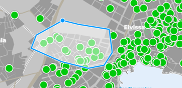
Allows selecting files from the map, drawing a polygon with the area of interest. The application highlights the selected files on the map, offers a list that can be saved in an Excel file and allows it to be filled in with alphanumeric filters.

The Cabildo de Lanzarote is the governing body of the island of Lanzarote (Canary Islands, Spain), serves 7 municipalities and a population of 150,000 inhabitants.

Categories

Congress and conferences
Transport and infrastructure
NexusTeam
GIS Solutions for City Councils
Smart Mobility
City Councils
Awards
Spatial intelligence
Geolocation
Article
APPS

Related news

pisos
Tue, 02/20/2018 - 00:00
Maps with 3D buildings with apartments and houses on the real estate portal Pisos.com
ematsa
Fri, 02/09/2018 - 00:00
A Touch screen application to inform of field-work water samples
TUS
Mon, 01/15/2018 - 00:00
GIS system of mobility and public transportation of Sabadell
aparkb
Fri, 01/05/2018 - 00:00
Nexus Geographics chosen by B:SM for the development and implementation of the "Where to park for minutes" platform
CONTACT
  • Barcelona Office
    Aragó 264 4, 08007 Barcelona
  • Girona Office
    Joaquim Botet Sisó 6, 17003 Girona
  • Madrid Office
    Paseo de la Habana 9-11, 28036 Madrid
  • +34 93 0172728
    info@nexusgeographics.com
  • TwitterYoutubeLinkedin Instagram
SECTORS
  • City councils
  • Public authorities
  • Mobility and sustainability
  • Service networks
  • Companies and businesses
  • Logistics
NEXUS
  • News
  • Work with us
  • Cercalia
  • enMapa
  • reCitty
  • Contact
OTHERS
  • BusManager
  • Routing Reparto
logo soclogo generalitatLogo eulogo next genenergia renovableENS
aeonorISO
Sello PYME INNOVADORA 11/02/2028
PYME INNOVADORA
Válido hasta el 11 de febrero de 2028
escudo de MEIC 11/02/2028
  • Quality and safety policy
  • Cookies policy
  • Privacity policy
  • Social media policy
  • Legal advice
  • Home
  • 25 years
  • News
  • Sectors
    • City councils
    • Public authorities
    • Mobility and sustainability
    • Service networks
    • Companies and businesses
    • Logistics
  • Tools
    • Cercalia
    • enMapa
    • Recitty
    • Custom solutions
  • Contact
    • Work with us